Site area & dimensions
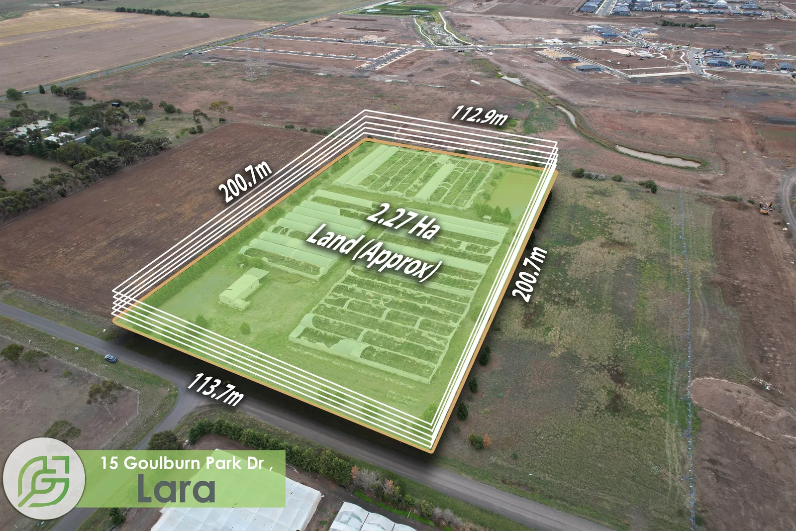
Published or briefed site area, key boundary dimensions and parcel scale can be placed directly onto the aerial frame.
Melbourne · Commercial site, boundary & amenity mapping
Sixth Vision Commercial turns aerial property media into a clearer sales and leasing tool by mapping the information enquiries repeatedly need: site area, boundaries, frontage, access, dimensions and surrounding amenity. The result is a marketing asset designed for commercial, industrial, land and development campaigns across Melbourne and Victoria.
A different job from a floor plan
A commercial floor plan shows how internal spaces connect. Measured site and boundary mapping works at the property or land level: where the subject sits, how large the holding is, where its boundaries run, what the frontage looks like and how it relates to roads, stations, retail, ports, ring roads or the CBD.
For many industrial, logistics, land and development campaigns, both layers can be useful in the same brief.
What can be mapped
Published or briefed site area, key boundary dimensions and parcel scale can be placed directly onto the aerial frame.
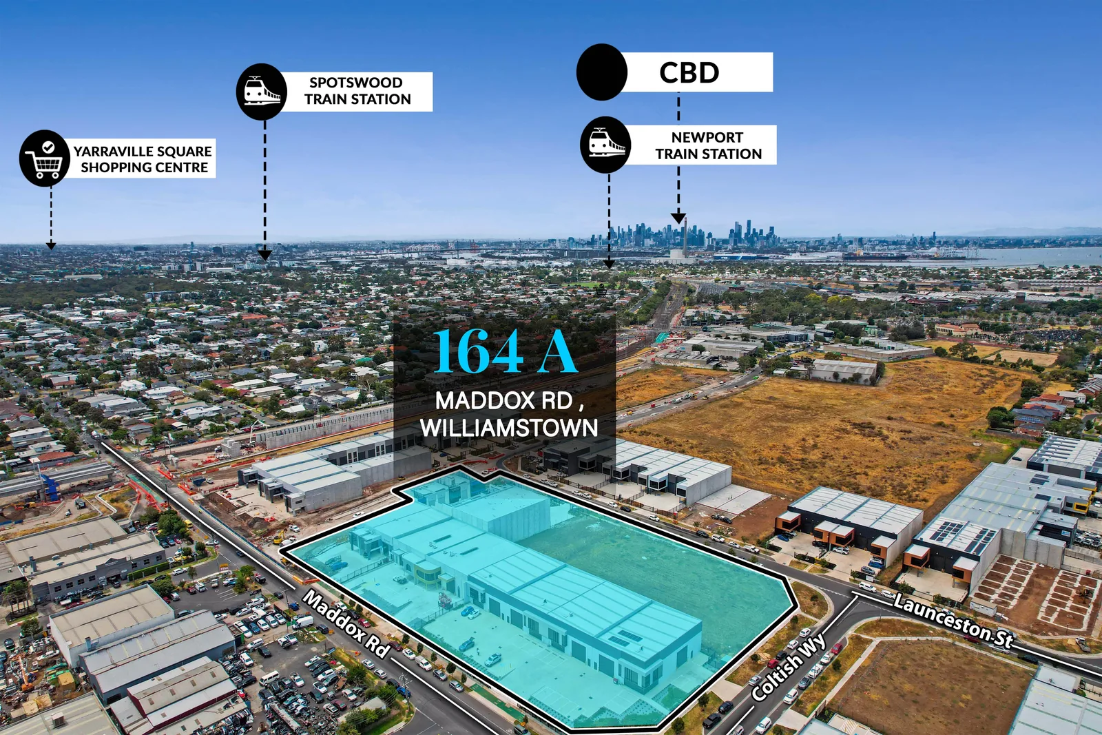
Subject-site outlines and frontage can make land, development and industrial holdings easier to identify at a glance.
Road approach, hardstand, loading areas and relevant access points can be highlighted when they are part of the marketing brief.
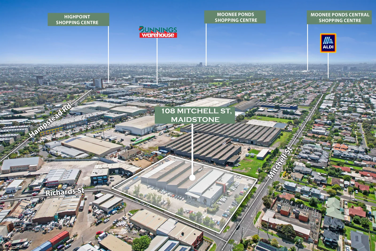
Stations, ring roads, ports, airport, CBD, retail centres and other relevant context can be positioned around the subject site.
Large parcels and development sites can be shown with dimensions and surrounding context without asking an enquiry to interpret a raw aerial alone.
Warehouses, estates and logistics assets can combine site identification with access, surrounding infrastructure and operational context.
Delivered proof
The examples below are Sixth Vision Commercial deliverables, not generic diagram mock-ups. They show different ways measured and contextual information can be integrated into commercial property media.
Where it fits
Measured mapping can be scoped alongside commercial property photography, CASA-certified aerial, film and commercial floor plans. Keeping those outputs in one visual system helps the agency present the asset consistently across portals, brochures, information memorandums and direct enquiry follow-up.
24-hour delivery is available for commercial photography. Mapping, measurement, video and larger briefs are scoped against the campaign deadline.
Direct answers
No. These are marketing plans and property-media overlays unless a separate professional or statutory scope is expressly agreed. Survey, title, planning, architectural or legal decisions should rely on the appropriate qualified documentation.
Yes. Where the brief provides or confirms the relevant information, site outlines, dimensions, area, frontage and contextual labels can be integrated into aerial property imagery.
Yes. Sixth Vision Commercial can combine still photography, CASA-certified aerial, film, measured floor plans and site or amenity mapping in one commercial campaign brief.
Melbourne & Victoria
Tell us whether the brief needs site area, boundary, dimensions, frontage, access or surrounding amenity. We will scope the leanest combination of photography, aerial and measured mapping for the campaign.