01 · Site identification
The subject property is outlined clearly so the viewer knows exactly which asset the aerial is selling.
Delivered work · Williamstown, Melbourne
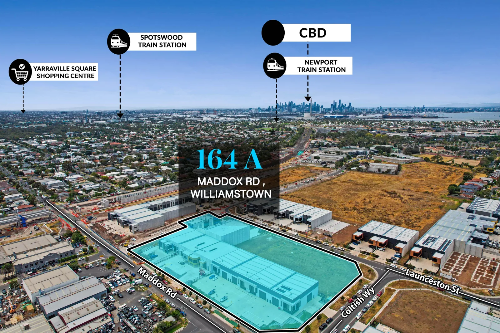
For 164A Maddox Road, Williamstown, the aerial deliverable identifies the site and adds the location relationships a commercial enquiry actually cares about: Melbourne CBD plus nearby Spotswood and Newport transport context.
The commercial problem
Commercial copy can describe proximity to the CBD, stations or arterial connections, but a marked aerial gives the enquiry a visual model of the asset's position immediately.
For industrial campaigns, that context helps the property read as part of a logistics and employment network rather than as an isolated building.
What the deliverable does
The subject property is outlined clearly so the viewer knows exactly which asset the aerial is selling.
Melbourne CBD is positioned in the same frame to show the site's wider metropolitan relationship.
Spotswood and Newport stations are identified to add practical location information to the marketing image.
Why this matters
Mapped aerials help agencies communicate access and context consistently across digital listings, information memoranda and direct enquiry. They can sit beside photography and plans as a factual campaign layer.
See Sixth Vision Commercial's Melbourne commercial-property capability →
Commercial & industrial · Melbourne
Send the address, campaign deadline and the information the enquiry needs to understand. Sixth Vision Commercial can scope photography, aerial, plans and mapping together.