01 · Aerial frame
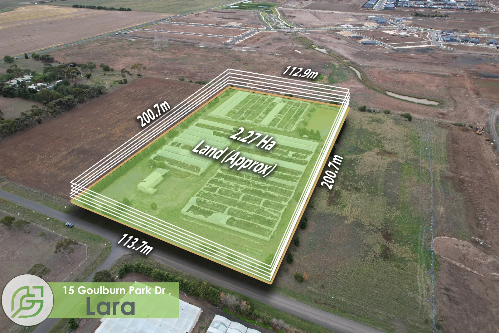
The property is shown from above at dusk, preserving both site scale and visual campaign impact.
Delivered work · Lara, Victoria
For this Lara land parcel, the brief went beyond aerial photography. Sixth Vision Commercial placed the site boundary and key dimensions directly onto a dusk aerial frame so an agent could send one image and give an enquiry immediate context on the scale of the holding.
The commercial problem
Land and development campaigns repeatedly generate the same early questions: how large is the holding, where does the boundary run, what is the frontage and how does the site sit in its surrounding context? A marketing image that carries those answers can do more work than a generic drone photograph.
This is why Sixth Vision Commercial combines photography with measured site, boundary, frontage and amenity mapping where the campaign needs it.
What was delivered
The property is shown from above at dusk, preserving both site scale and visual campaign impact.
The site perimeter is made legible directly on the image rather than forcing the viewer to cross-reference another document.
Key boundary measurements are placed where they can be read immediately in the marketing frame.
Why this matters
For an agent, developer or owner, measured aerial media can make a site easier to explain on portals, in brochures, in an information memorandum and in direct enquiry follow-up. It does not replace survey or legal documentation; it makes the campaign more legible.
See Sixth Vision Commercial's Melbourne commercial property photography capability →
Land · Industrial · Development
Send the address, campaign deadline and the information your enquiry needs to understand. Sixth Vision Commercial can scope photography, CASA-certified aerial and measured mapping together.